Chiang Dao National Park
Chiang Dao National Park
บ้านนาหวาย Tambon Mueang Na, Amphoe Chiang Dao, Chang Wat Chiang Mai 50170, Thaïlande
Located 87 km north of Chiang Mai, Chiang Dao National Park (Pha Daeng) spans 1,155 km² with karst peaks, waterfalls, caves, and Lisu and Karen villages.
Chiang Dao National Park, officially renamed Pha Daeng National Park in 2006, covers 1,155 km² in the mountainous foothills north of Chiang Mai, near the Myanmar border. Waterfalls, karst peaks, diverse wildlife, and villages of the Lisu and Karen minorities make it an ecotourism destination appreciated for its distance from conventional tourist circuits.
Why visit Chiang Dao National Park
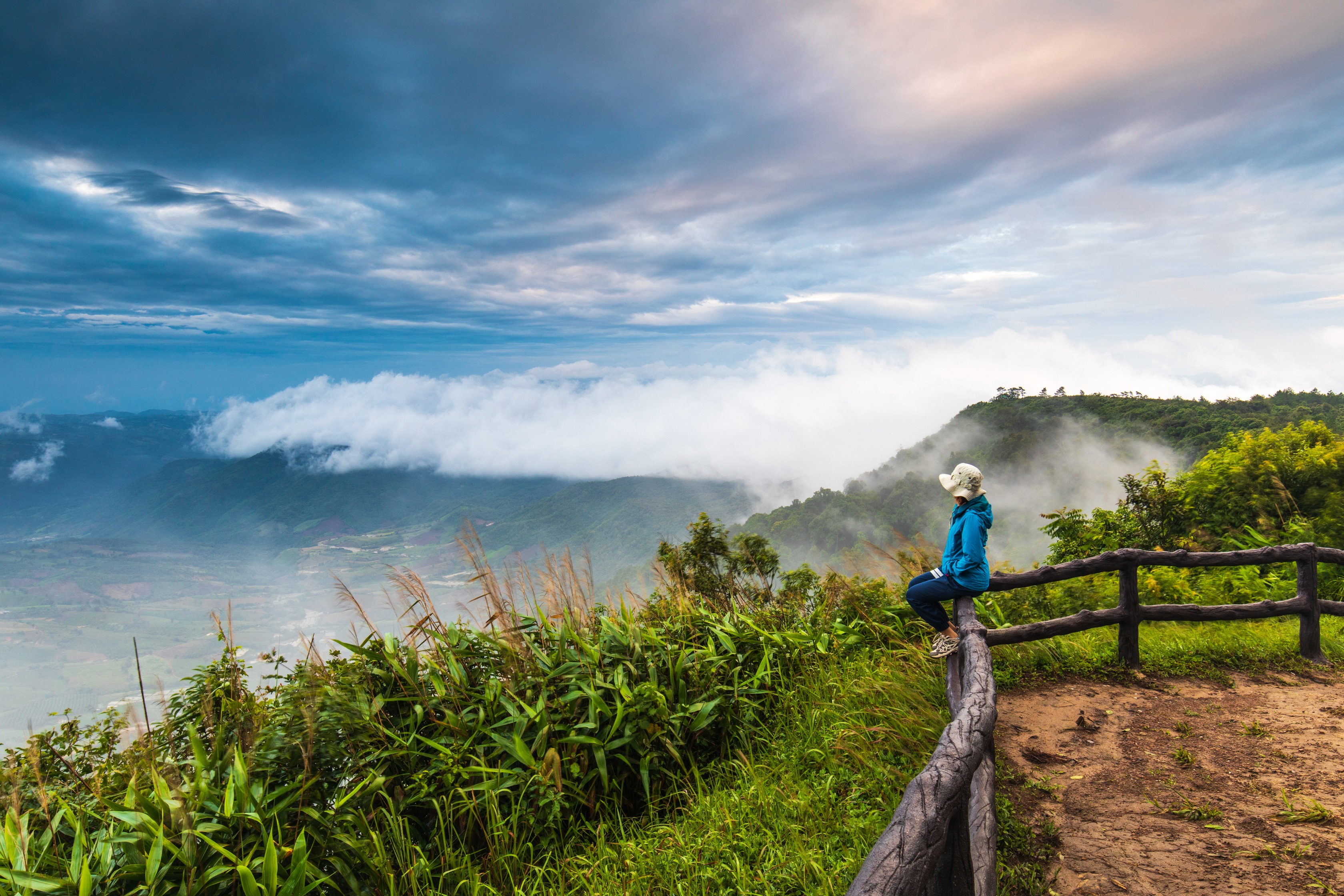
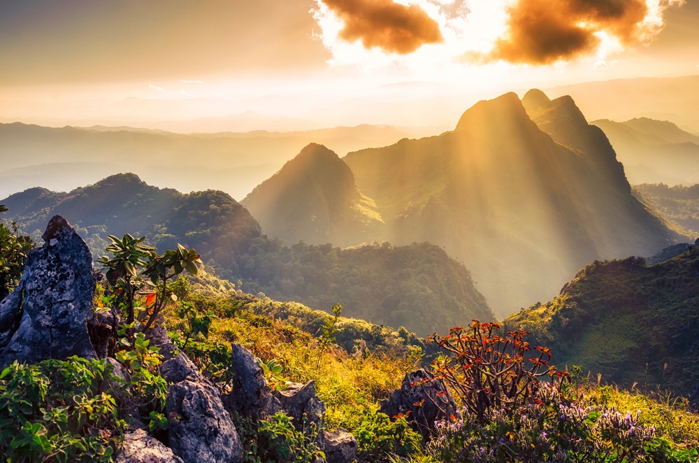
Dramatic mountain terrain, with several peaks exceeding 1,500 meters and viewpoints overlooking neighboring Burma.
Notable biodiversity: gaurs, banteng, gorals, langurs, barking deer, and numerous bird species.
Accessible waterfalls on foot (Pang Tong, Si Sangwan) and two natural caves to explore.
Encounters with the Lisu and Karen communities living within the park.
A cooler climate than the rest of Thailand, particularly pleasant in winter.
Park history
The protected area was established in 2000 within Chiang Dao's administrative territory. It encompasses the subdistricts of Muang Na, Thung Khao Puang, Ping Khong, Chiang Dao, Piang Luang, Saen Hai, and Wiang Haeng. The site, once a state forest domain, was initially named "Chiang Dao National Park," after the former royal forest and surrounding district.
This name created confusion with the neighboring wildlife sanctuary, which bears the same name. To clarify signage and visitor information, the site was officially renamed Pha Daeng National Park in March 2006. Both names remain used interchangeably in guides and local signage.
What to see and do
Peaks and viewpoints
The park's terrain is dominated by several peaks: Doi Kham Fa, Doi Daeng, Doi Phadang, Doi Danfak, Doi Khampra, Doi Lekjee, Doi Tuai, and Doi Puk Phukka. Most hiking trails concentrate in the western section, which is more densely forested and richer in wildlife. The eastern section, composed of sedimentary rock, presents a more mineral landscape.
Two viewpoints stand out. Yod Doi Tuai, in the northern section, opens onto the canopy and Burmese reliefs on clear days. The viewpoint at "km 45," halfway between Mae Cha and Peang Luang, overlooks Chiang Dao wildlife sanctuary.
Waterfalls
Pang Tong waterfall cascades over 50 meters down the rocks before plunging from the cliff. The basin at the foot of the falls allows for refreshing bathing during the dry season. Si Sangwan waterfall, more impressive, drops 20 meters in three successive stages; the access trails traverse mixed forests where rare orchids grow.
Caves
Two cavities are accessible from the trails. Klap cave measures about ten meters and harbors stalactite and stalagmite formations. Pha cave, shorter, is easier to access. Both shelter bat colonies.
Flora and fauna
The park's forests combine dipterocarps, pines, bamboo, Shorea obtusa, ebony, and Indian mahogany. For wildlife, you can observe barking deer, flying squirrels, wild boar, porcupines, and rarer species such as gorals, gaurs, banteng, and langurs. Trail traffic remains modest, favoring observation at sunrise and sunset.
Lisu and Karen villages
Several villages of the Lisu and Karen communities are located within the park's boundaries. Agriculture and livestock are their primary sources of income. English-speaking local guides organize visits from the visitor center; it is recommended to go through them to respect local customs.
Practical information
Visitor center: Na Wai village, Chiang Dao district. This is where you pay entry and obtain trail information.
Admission fees: dual pricing applied by the Department of National Parks (DNP), with reduced rates for Thai residents and children. As amounts are regularly revised, it's best to inquire on-site or through your tour operator.
Accommodation: a few bungalows managed by the DNP allow overnight stays. Capacity is limited; reservations are advisable during peak season.
Equipment: hiking shoes, warm clothing for winter nights, headlamp for caves, water, and snacks (no shops within the park).
When to visit
The park ranks among Thailand's coolest zones. In winter, maximum temperatures hover around 26°C and can drop to 7-8°C at night. Visitation peaks during the first and last two months of the year (January-February and November-December), which correspond to the most favorable hiking conditions.
The period of June to September should be avoided: heavy rains make trails slippery and climbing dangerous. May and October are acceptable shoulder seasons, more humid but less crowded.
How to get there
The park is located 87 km north of Chiang Mai: 75 km on the main highway (Highway 107 toward Fang), then 12 km on a secondary road to reach the Na Wai visitor center.
Rental car: the simplest option. The road is paved but winding on the final kilometers.
Private vehicle with driver: a comfortable option from Chiang Mai, to be arranged through a local tour operator.
Public transport: buses connect Chiang Mai to Chiang Dao town, but you'll then need to find a songthaew or taxi to reach the park, complicating a same-day round trip.
Allow 2 to 3 hours by car from central Chiang Mai depending on traffic.
Nearby attractions
The Chiang Mai and Chiang Dao area offers several complementary sites:
Chiang Dao cave: a karst system stretching several kilometers, housing a Buddhist shrine.
Doi Luang Chiang Dao: Thailand's third-highest peak (2,175 m), accessible on guided trek with permission.
Hot springs in the region, perfect for a break after a day of hiking.
Back in town, iconic temples such as Wat Phra Singh, Wat Chedi Luang, or Wat Sri Suphan.
For urban immersion, Warorot Market in the heart of Chiang Mai.
Frequently asked questions
Frequently asked questions
For main trails and waterfalls, a guide is not mandatory. It is highly recommended, however, for climbing the neighboring Doi Luang Chiang Dao and for visiting Lisu and Karen villages, where a local guide facilitates interaction.
One day allows you to combine a waterfall, a viewpoint, and a cave. To explore multiple sectors and meet mountain communities, plan for two days with an overnight stay in a bungalow.
Yes, provided you choose short trails such as those leading to waterfalls or caves. Summit ascents and certain climbing sections are reserved for experienced hikers.
Yes. Many Chiang Mai agencies offer 2 to 4-day circuits combining the park, Chiang Dao wildlife sanctuary, minority villages, and Doi Luang Chiang Dao.
These are two distinct and adjacent protected areas. The national park (Pha Daeng) is open to hiking and ecotourism; the neighboring wildlife sanctuary is more conservation-focused with more restricted access.
Plan your trip
Chiang Dao National Park naturally fits into an itinerary in northern Thailand, between Chiang Mai temples, rural treks, and border crossings toward the Golden Triangle. To build a custom circuit including this massif and mountain communities, consult our Thailand travel ideas.
Photos
Interested in this visit?
We can include it in your personalised itinerary.