Phu Kradueng National Park
A basalt plateau rising to 1,316 meters in Loei Province, Phu Kradueng combines pine forests, alpine meadows and panoramic cliffs. A 9 km hike leads to the summit, open from October to May.
Phu Kradueng is a basalt plateau peaking at approximately 1,316 meters altitude in Loei Province, northeastern Thailand. The national park protecting it covers over 340 km² of temperate forests, high-altitude meadows and cliffs offering sweeping views across the plain below. It's one of the rare places in Thailand where temperatures drop noticeably in winter, drawing hikers and nature enthusiasts from around the world.
Essential information at a glance
- Entrance: paid (national park fee plus supplement for foreign visitors)
- Annual closure: the park closes each year from June to September (rainy season) to allow ecosystem regeneration
- Recommended duration: minimum 2 days / 1 night to enjoy the plateau; 3-4 days to explore the trails
- Access: from Loei by bus or minivan to Phu Kradueng town, then mandatory hike to the plateau (approximately 9 km uphill)
- Porters: local porters are available at the base of the trail to carry luggage and equipment
- Accommodation: bungalows and camping areas managed by the Department of National Parks on the plateau
- Gear: hiking boots essential; warm clothing in cool season (November-February)
- Accessibility: not accessible — the ascent is an unimproved hiking trail
What you'll see
The upper plateau harbors a mosaic of landscapes: scattered pine forests, grassy meadows dotted with tree ferns and wetland areas. Wildlife includes wild elephants, gaur, sambar deer and a rich variety of bird species. In season, the meadows bloom with wildflowers, notably the characteristic pink rhododendrons.
History and context
Phu Kradueng was designated a national park in 1962, becoming one of Thailand's first. Its name literally means "bell-shaped mountain" in Thai, referring to the plateau's silhouette from a distance. The site remained a pilgrimage destination for local Buddhists for centuries before opening to hiking tourism in the second half of the 20th century.
Highlights of your visit
The ascent via the main trail
The trail from the visitor center to the plateau spans approximately 9 km with significant elevation gain. The route passes through several distinct vegetation zones, from dense tropical forest to high-altitude pine forests. Shelters dot the path for rest stops.
The cliffs and viewpoints
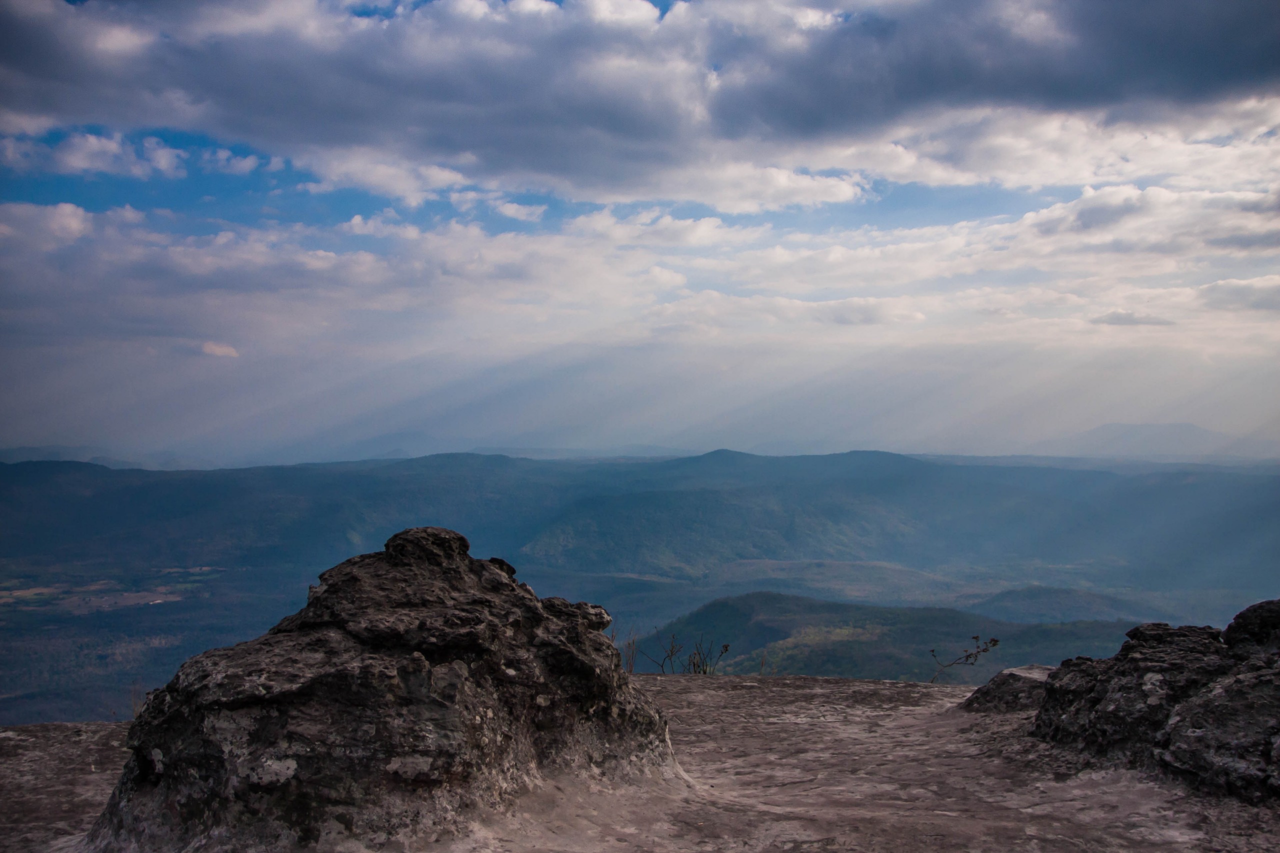
The plateau is edged by several cliff faces offering panoramic views over the Loei plain. Pha Nok An, to the east, is renowned for sunrise viewing. Pha Lom Sak, to the northwest, affords sweeping vistas across surrounding hills, particularly striking during the dry season when morning mist blankets the valleys below.
The meadows and wildlife
The central plateau's expansive meadows offer the best opportunities to spot deer and birds at dawn or dusk. Signboards mark areas where wildlife is regularly sighted. Elephants tend to frequent forest areas away from main trails.
The plateau's trail network
Once at the summit, a network of marked trails allows exploration of the plateau over one or several days. Distances between points of interest are indicated by signs in Thai and English. Most hikers complete a circuit covering the main viewpoints in 4 to 6 hours.
Photography tips
Sunrise from Pha Nok An is the park's most photographed moment: arrive at least 30 minutes before dawn. Golden light in late afternoon flatters the pine meadows beautifully. From November to December, morning mist creates striking atmospheric layers when viewed from the cliffs. No particular photography restrictions are noted in areas open to the public.
Location and access
The park sits in Phu Kradueng District, roughly 80 km south of Loei town. From Loei, regular buses and minivans serve Phu Kradueng town. From Bangkok, overnight buses connect directly to Loei. No road reaches the plateau: the hike up is mandatory for all visitors. The visitor center and parking lot are at the base of the trail.
In the vicinity
- Phu Ruea National Park — another high-altitude plateau in Loei Province, more accessible, known for some of Thailand's coldest winter temperatures.
- Loei Town — provincial capital with local markets and a logistical hub for exploring the region.
- Dan Sai — town famous for the Phi Ta Khon festival, one of the country's most colorful mask festivals.
Frequently asked questions
The dry season, October to February, is ideal. Cool temperatures (sometimes near 0°C at night in December-January) make hiking pleasant. The park closes from June to September.
The 9 km ascent with elevation gain requires good fitness. Porters are available for baggage. Most visitors in reasonable health make it in 3 to 5 hours.
Yes. The Department of National Parks operates bungalows and camping on the plateau. Advance booking is advised, especially during peak season (November-January) and weekends.
Hiking boots are essential. During the cool season, pack warm layers, a windbreaker and a sleeping bag rated for near-freezing nighttime temperatures.
Food stalls and simple restaurants operate on the plateau during the open season. Offerings remain basic; bringing supplementary provisions is recommended.
Yes. Phu Ruea and Dan Sai are accessible from Loei in a day trip. Allow 4 to 5 days to comfortably combine these three destinations.
Interested in this visit?
We can include it in your personalised itinerary.