Ban Nor Lae
Ban Nor Lae
Doi Ang Khang, Mae Sun, Amphoe Fang, Province de Chiang Mai 50320, Thaïlande
A Palaung village clinging to the Doi Ang Khang massif, facing the Burmese border, Ban Nor Lae exemplifies the agricultural reinvention of Thailand's Golden Triangle.
Ban Nor Lae is a Palaung village perched on the Doi Ang Khang massif, at the far north of Chiang Mai province, facing the Burmese border. The hamlet, the most remote of a trio of ethnic villages, lives to the rhythm of tea plantations and crops introduced by Thai Royal Projects.
Why visit Ban Nor Lae
Three elements set Ban Nor Lae apart from other hill tribe villages in northern Thailand. First, its geography: perched at 1,800 meters altitude on the Doi Ang Khang ridge, the village offers a direct vantage point over Burmese hills. Second, Palaung identity—a Burmese community settled here for a few decades, preserving its language, colorful traditional dress, and distinctive Buddhist practices. Finally, the agricultural context: Ban Nor Lae sits at the heart of an area that, half a century ago, lived from opium cultivation and has since shifted toward diversified mountain agriculture thanks to a royal development program.
The visit appeals to those interested in ethnological, agricultural, and landscape matters, rather than to those seeking purely contemplative moments.
History: from opium to Royal Projects
The Doi Ang Khang sector belongs to Thailand's slice of the Golden Triangle, long associated with opium cultivation. Until the 1960s, highland farmers grew poppies, distributed through cross-border networks that fueled regional war economies.
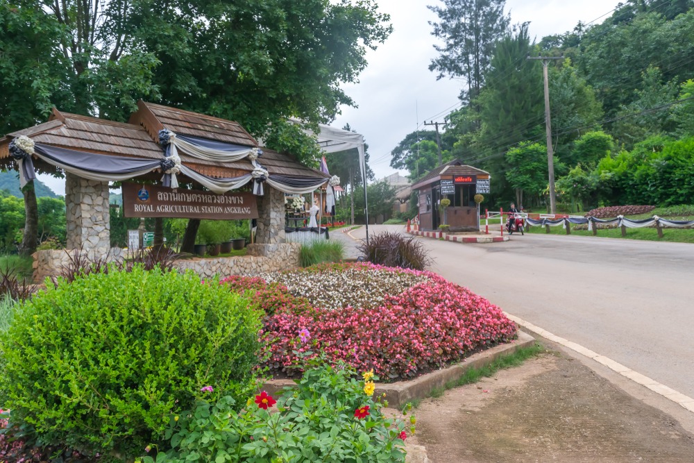
In 1969, King Bhumibol Adulyadej (Rama IX) launches the Ang Khang Royal Agricultural Research Station, the first Royal Projects initiative designed to replace opium with legal crops in the mountainous northern zones. Agronomists there test varieties suited to cool highland climates: plums, raspberries, strawberries, persimmons, as well as temperate vegetables and ornamental flowers. The program is accompanied by technical support for mountain communities, including the Palaung of Ban Nor Lae.
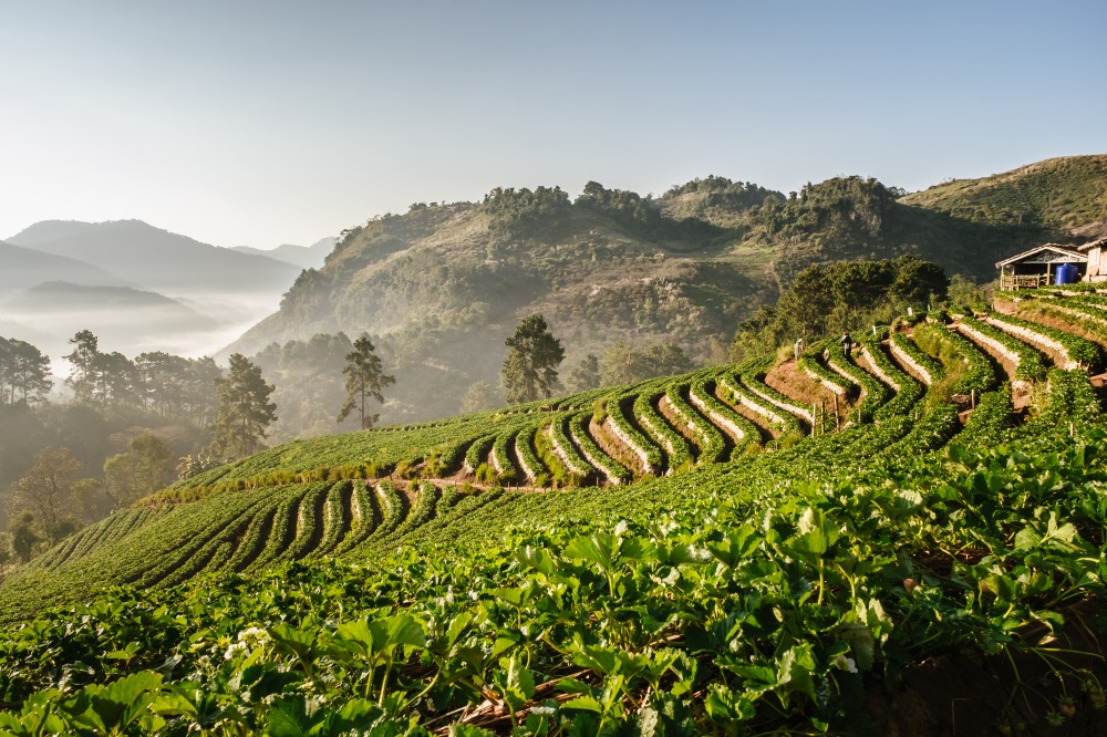
A few decades later, poppies have vanished from the fields, replaced by tea, coffee, maize, sweet potato, and fruit orchards. Crop rotation, practiced by residents, limits soil depletion and fertilizer dependency.
What to see and do
The village and Palaung community
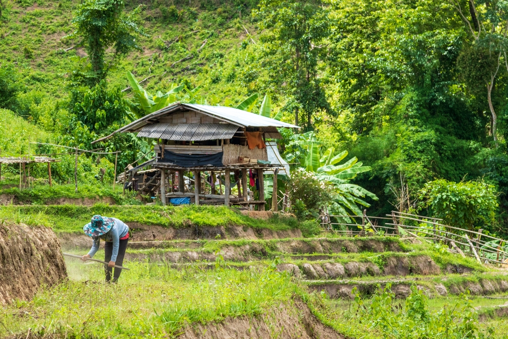
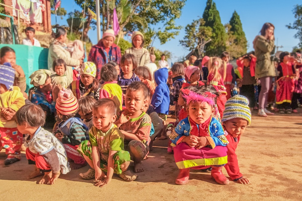
The Palaung of Ban Nor Lae descend from a Burmese ethnic group that migrated to Thailand in the 20th century. They wear bright traditional dress daily, speak their own language (Thai is little practiced), and transmit from generation to generation a Buddhism punctuated by community celebrations. Wooden dwellings are modest, aligned on slopes amid cultivations.
The plantations
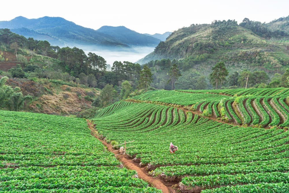
Strolling through the village naturally leads to tea plantations covering the hillsides. Depending on the season, you can witness leaf harvesting. Alongside tea plants are fields of coffee, maize, and sweet potato, as well as strawberry orchards in the lower reaches.
Crafts and local products
Palaung women practice embroidery and basketry. On village stalls, you'll find woven bags, wicker hats, plant-fiber jewelry, loose-leaf tea, and in season, fresh strawberries or strawberry juice. The culinary specialty to taste is grilled sweet potato, prepared in several village shops.
Practical information
- Visit duration: allow about 2 hours to walk through the village and its surroundings.
- Altitude and climate: temperature hovers around 16°C much of the year; pack a warm layer.
- Access: winding mountain road, not recommended for inexperienced drivers.
- Accommodation: a few homestay options exist in the Ang Khang area; book ahead, availability is limited.
- Useful purchases: Palaung crafts and agricultural products directly support the local community.
When to go
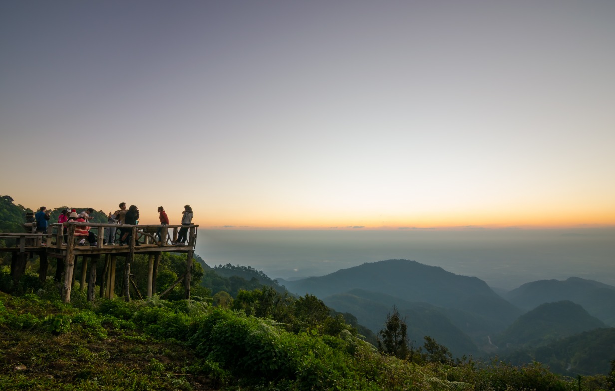
The recommended period runs from November to April, during the cool and dry season in northern Thailand. The sky is generally clear, allowing you to enjoy the panorama over Myanmar and drive mountain roads without hindrance. December and January are the coolest months: nights can approach freezing at this altitude. The rainy season (June to October) makes trails slippery and visibility uncertain.
How to get there
Ban Nor Lae is located about 160 km from Chiang Mai, on the Doi Ang Khang massif.
- By car: take Route 107 toward Fang for about 137 km to the Mae Kha market, turn left and continue 25 km toward Doi Ang Khang; signs then point to the village.
- By songthaew: connections exist from Fang or Chai Prakan, but they are irregular.
- Journey time: allow half a day from Chiang Mai given mountain hairpins.
A personal vehicle (4x4 or car in good condition) remains the most practical solution to combine Ban Nor Lae with other points of interest on the massif.
Nearby attractions
- The Doi Ang Khang massif and its royal agricultural research station, a few kilometers away.
- Ban Khum, the second ethnic village on the massif, more accessible than Ban Nor Lae.
- Ban Khop Dong, the third village of the trio, to combine in the same loop.
- Wat Tham Pha Plong, a meditation temple nestled in forest, on the route between Chiang Mai and Doi Ang Khang.
- Chiang Mai, the logical starting point for the circuit.
Frequently asked questions
Take Route 107 toward Fang for about 137 km to the Mae Kha market, turn left and continue 25 km toward Doi Ang Khang, then follow signs. Allow half a day because of mountain hairpins.
November to April, during the cool and dry season. Clear skies let you enjoy the Myanmar views and temperatures stay around 16°C during the day.
A few homestays and lodges exist in the Ang Khang area. Availability being limited, it's best to book ahead, especially during high season.
Palaung embroidery and basketry (bags, hats, woven jewelry), local tea, and in season fresh strawberries or strawberry juice. Buying on-site supports producers directly.
An ethnic minority of Burmese origin living in northern Thailand's highlands. They speak their own language, wear colorful traditional dress, and practice Buddhism passed down through generations.
To include Ban Nor Lae in a northern Thailand itinerary, check out our Thailand travel suggestions.
Photos
Also discover
Ban Khum
An agricultural village at 1,300 m altitude north of Chiang Mai, Ban Khum is the legacy of the royal project that replaced opium poppies with strawberries and flowers.
Doi Ang Khang Massif
A massif in northern Thailand near Chiang Mai, Doi Ang Khang combines a royal agricultural station, temperate orchards and Lahu and Palaung villages on the Burmese border.
Fang
At the gateway to northern Chiang Mai, Fang reveals its thermal springs, misty peaks, and ethnic villages—far from the beaten tourist path.
Ban Khop Dong
Highland Lahu village in the Doi Ang Khang massif, north of Chiang Mai. Animist culture, mountain agriculture and history linked to the Royal Project.
Interested in this visit?
We can include it in your personalised itinerary.