Phu Chong Na Yoi National Park
Phu Chong Na Yoi National Park
C7M2+PVF, Na Chaluai, Na Chaluai District, Ubon Ratchathani 34280, Thaïlande
At the confluence of Thailand, Laos, and Cambodia, Phu Chong Na Yoi National Park protects 686 km² of waterfalls, sandstone plateaus, and forests.
At the confluence of Thailand, Laos, and Cambodia, Phu Chong Na Yoi National Park protects 686 km² of forests, waterfalls, and sandstone plateaus. Located in Ubon Ratchathani province, in the far northeast of the country, it remains one of Thailand's least-visited parks, nicknamed the "Emerald Triangle" in reference to its position at the convergence of three borders.
Why visit Phu Chong Na Yoi
The park combines several assets rarely found on a single site: waterfalls fed by year-round streams, sweeping views over the Mekong basin, sandstone rock formations sculpted by erosion, and low tourist traffic. Its border location also makes it a place rich in recent history, and a vantage point for flora enthusiasts (orchids, wildflowers) as well as forest wildlife observers (birds, small mammals, reptiles).
Park history
During regional conflicts in the second half of the 20th century, the remote forests of Ubon Ratchathani harbored border camps housing Cambodian refugees fleeing violence. The area, which remained sparsely populated and difficult to access, was converted into a protected reserve in 1987 to preserve its ecosystems. The remoteness that long hindered its development also explains the current good conservation of its forest environments.
What to see in the park
Waterfalls
Water falls form the park's main attraction. The Namtok Huai Luang cascade drops approximately 40 meters from a sandstone cliff. A trail allows you to reach its top for varying viewpoints, while a basin and small beach below lend themselves to swimming when water flow permits.
A few kilometers south, the Namtok Koeng Mae Phong cascade, fed by the Lam Dom Noi stream, tumbles over rocks to form a modest natural basin. Further downstream, the Kaeng Sila Thip rapids have carved a succession of circular cavities in the rock, which locals call "Kumphalak." These giant potholes, of varying sizes, can be discovered on foot when water levels drop.
Viewpoints and sandstone plateaus
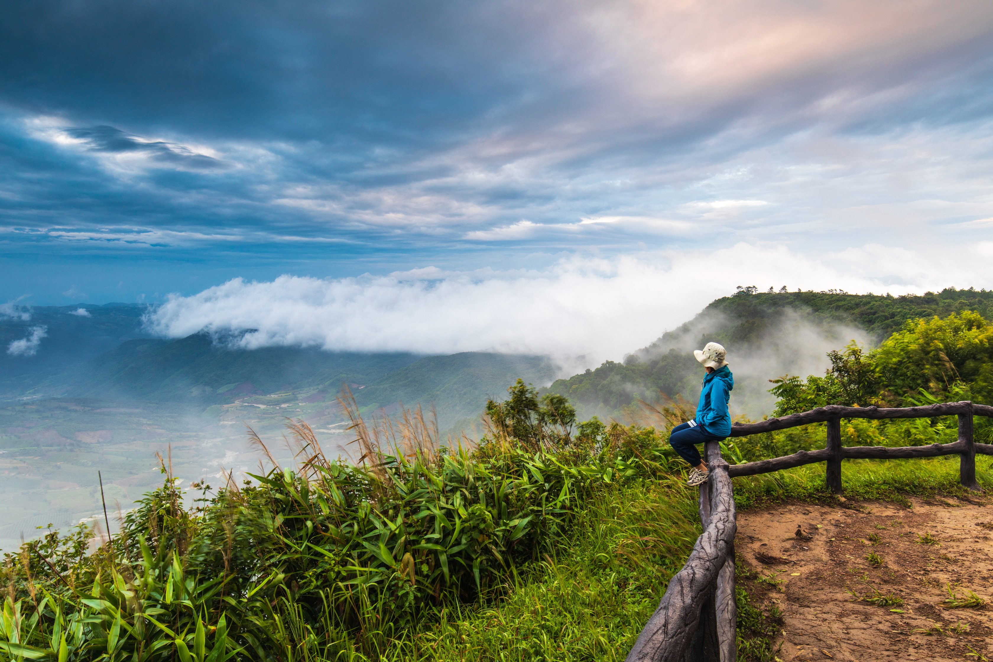
From the main entrance, a trail leads to the Pha Pheung cliff, which offers an unobstructed panorama over the border zone. The other major vantage point is the sandstone mountain of Phu Hin Drang, from where the view extends over the surrounding forest and the Mekong basin. In the cool season, a blanket of mist frequently covers the plateau at sunrise. The site also stands out for its geological formations: terraces, fissures, grooves, and concave basins in the sandstone.
The rocky terrace of Phlan Kong Kwian, whose nickname means "wagon terrace," takes its name from travelers who once sheltered there. The area hosts varied flora, particularly visible at the beginning and end of the rainy season.
Practical information
Hours: the park opens early in the morning until late afternoon; access to waterfalls closes earlier, in mid-afternoon. Verify current hours at the entrance.
Entrance fee: an access fee applies to foreign visitors, as in all Thai national parks.
Length of visit: allow half a day for the main waterfalls, a full day if you combine hiking and viewpoints.
Accommodation: bungalows and a camping site are managed by the park administration; reservation recommended during peak season.
What to bring: water, closed hiking shoes, insect repellent. Mobile network coverage is limited within the park.
When to visit
The cool season, from November to February, offers the most favorable conditions: temperatures between 25 and 30°C, clear skies, dry trails. It's also the period when morning mist covers Phu Hin Drang. From March to May, temperatures often exceed 35°C, making hikes more strenuous but keeping swimming pools accessible. The rainy season, from June to October, swells the waterfalls and gives the park its most verdant appearance, at the cost of muddy trails and regular thunderstorms.
How to get there
The gateway city is Ubon Ratchathani, connected to Bangkok by air (daily domestic flights), overnight train, and long-distance bus. From Ubon Ratchathani, the park is approximately two hours' drive to the southeast; rental car or private taxi are the most practical solutions, as public transport is rare on the final kilometers.
Nearby
The Ubon Ratchathani region concentrates several complementary sites. Along the Mun River, which crosses the province, fishing villages and markets dot the banks. In terms of religious heritage, the Wat Phra That Nong Bua and its Indian-inspired stupa can be visited in the city of Ubon Ratchathani itself.
Frequently asked questions
Frequently asked questions
No specific permit is required: simply pay the entrance fee at the gate. Foreign visitors pay a higher rate than Thai residents.
Yes, the administration manages a camping site as well as a few bungalows near the main entrance. Reservation is recommended during the cool season, the busiest period.
Half a day is enough for Namtok Huai Luang cascade and the Kaeng Sila Thip rapids. To combine waterfalls, viewpoints, and sunrise over Phu Hin Drang, plan an overnight stay.
The basin at the foot of Namtok Huai Luang allows swimming in the cool season and early hot season. Avoid swimming during and after heavy rains, when currents become dangerous.
The areas around waterfalls and the basin are easily accessible. Hikes to Phu Hin Drang, however, require good physical fitness and proper footwear.
Integrating Phu Chong Na Yoi into your trip
Phu Chong Na Yoi lends itself to a nature stopover in a circuit dedicated to northeastern Thailand (Isan), a region still little traveled by international visitors. To build an itinerary combining Ubon Ratchathani, its parks, and its temples, consult our Thailand travel suggestions.
Photos
Interested in this visit?
We can include it in your personalised itinerary.